
 Topograph · User guide
Reliable, clear maps for 4x4 and hiking — with or without signal. Here's how to use Topograph.
An iPhone running iOS 18 or later.
Turned on for Topograph — the app asks the first time you open it.
One week free, then a weekly or annual plan — see below.
The online map, search and downloads need a connection. Once a region is downloaded you don't.
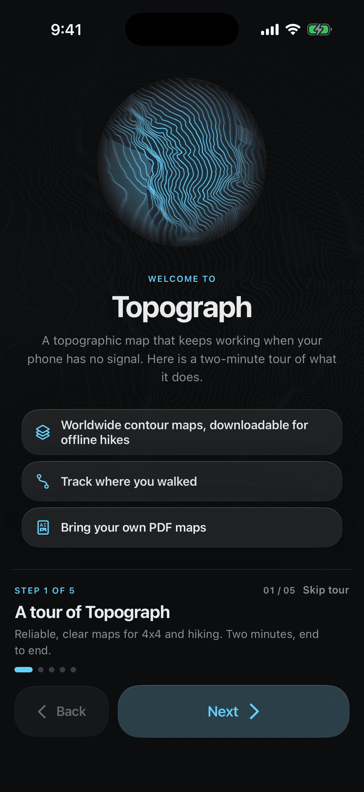
The first time you open Topograph it runs a short, five-step tour — about two minutes — and you can Skip tour at any point. Nothing in the tour uses the internet: the samples are bundled with the app.
Topograph is a subscription app. On the last step you choose a plan:
Starts with one week free, then renews weekly.
No free week, and cheaper per week than the weekly plan. The Save badge is worked out from the two prices, not written in.
Every price you see comes from the App Store for your country, so it may differ from what someone else sees. The renewal line states what you will be charged and when. Restore purchase brings back a subscription you already hold on this Apple ID, and the Terms of Use and Privacy Policy links are on the same screen.
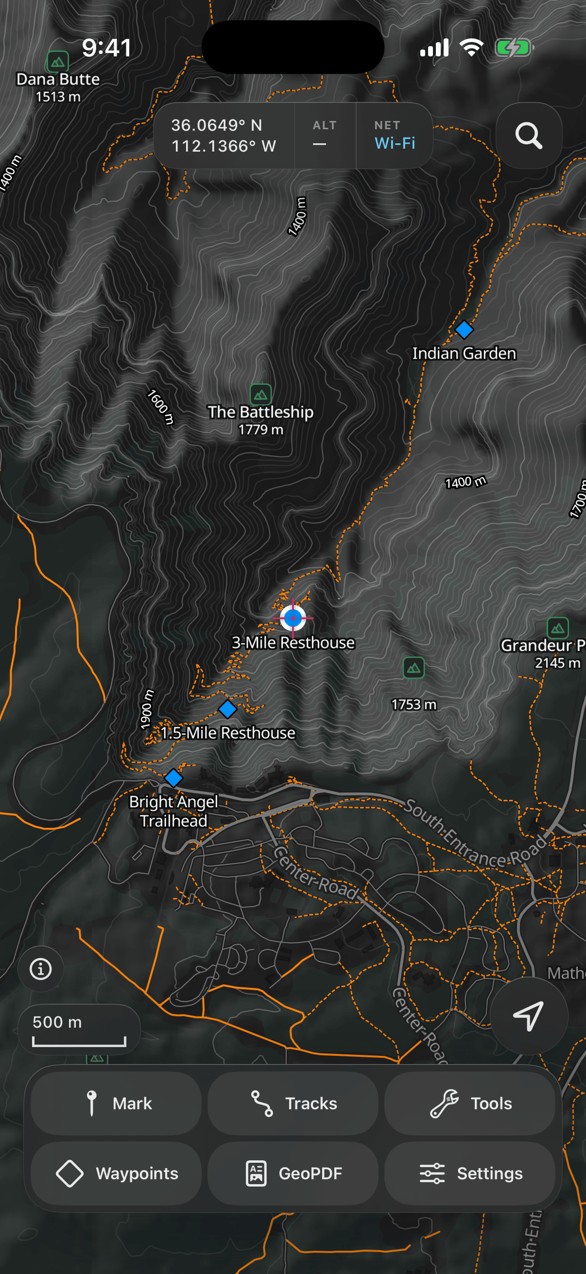
The map fills the screen. A row of readouts sits at the top — your position, altitude and connection — with the search key beside it, and an action panel floats over the bottom. The connection goes amber when there isn't one. Tap the location button (bottom right) to cycle: centre on you → follow you → orient the map to your heading. The scale bar bottom left shows the exact zoom level when you tap it.
What you see is a full topographic map: contour lines with labelled heights, shaded relief that makes ridges and valleys readable at a glance, trails and tracks, and peaks and huts with their names and heights. The map follows your phone's Light or Dark appearance.
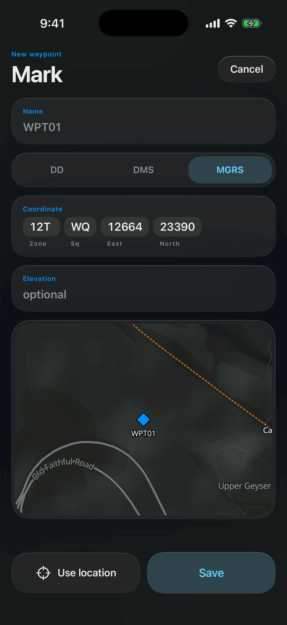
Tap the position readout and the coordinate goes to the clipboard in whichever format you've chosen — decimal degrees, DMS or MGRS.
A waypoint diamond is always drawn, but never hides the map under it. Zoomed out, overlapping marks gather into a numbered circle — tap it to zoom in.
Tap the magnifier beside the readouts. One field searches places (Apple Maps when you have signal, and a database of 171,000 place names built into the app when you don't), your waypoints, tracks and imported PDF maps by name, and coordinates in any format the app reads. The heading above the results says which source answered.
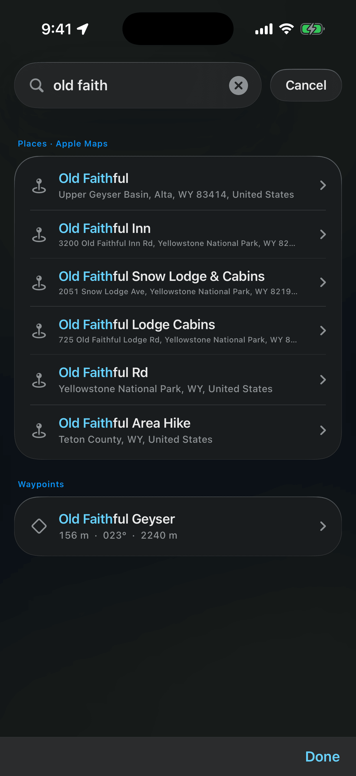
Tap a result and it does the obvious thing: a place or coordinate takes the map there, a track is shown on the map, a PDF map opens. A place you find gets a marker with its name and a bar at the top — + Add saves it as a waypoint, the ✕ clears it, and tapping the bar flies you back to it. Natural features — mountains, lakes, creeks — are found as well as towns, and you can write a name the short way: Mt Franklin, Reedy Ck.
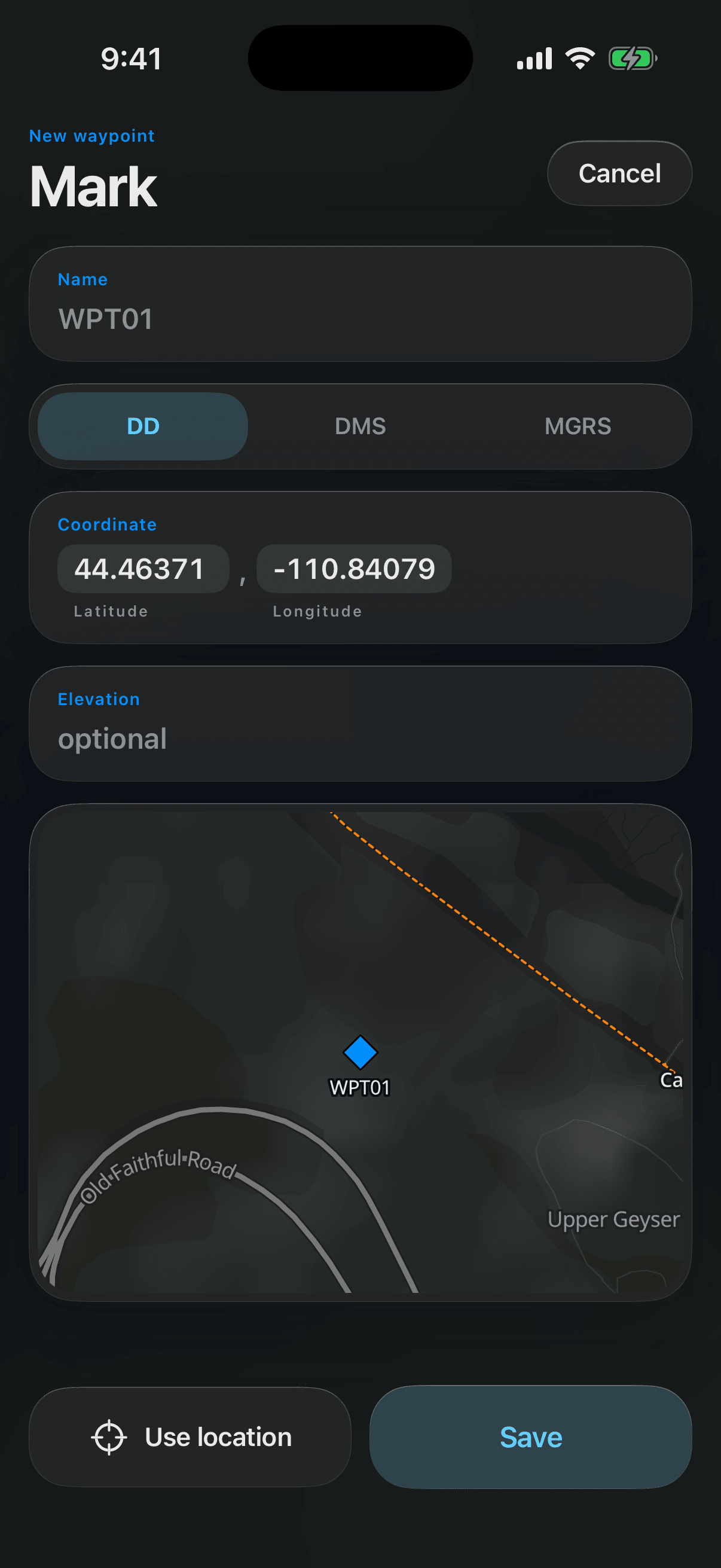
Tap Mark. The crosshair in the centre of the map is where the new waypoint starts — pan the map to move it, press and hold the small map at the bottom of the form to put it exactly where you held, or tap Use location to jump to your GPS fix. Type a name (it defaults to WPT01, WPT02, …), enter the coordinate as decimal degrees, DMS or an MGRS grid reference, add an elevation if you know it, and Save. If something doesn't read as a coordinate, a line under the field says what to change.
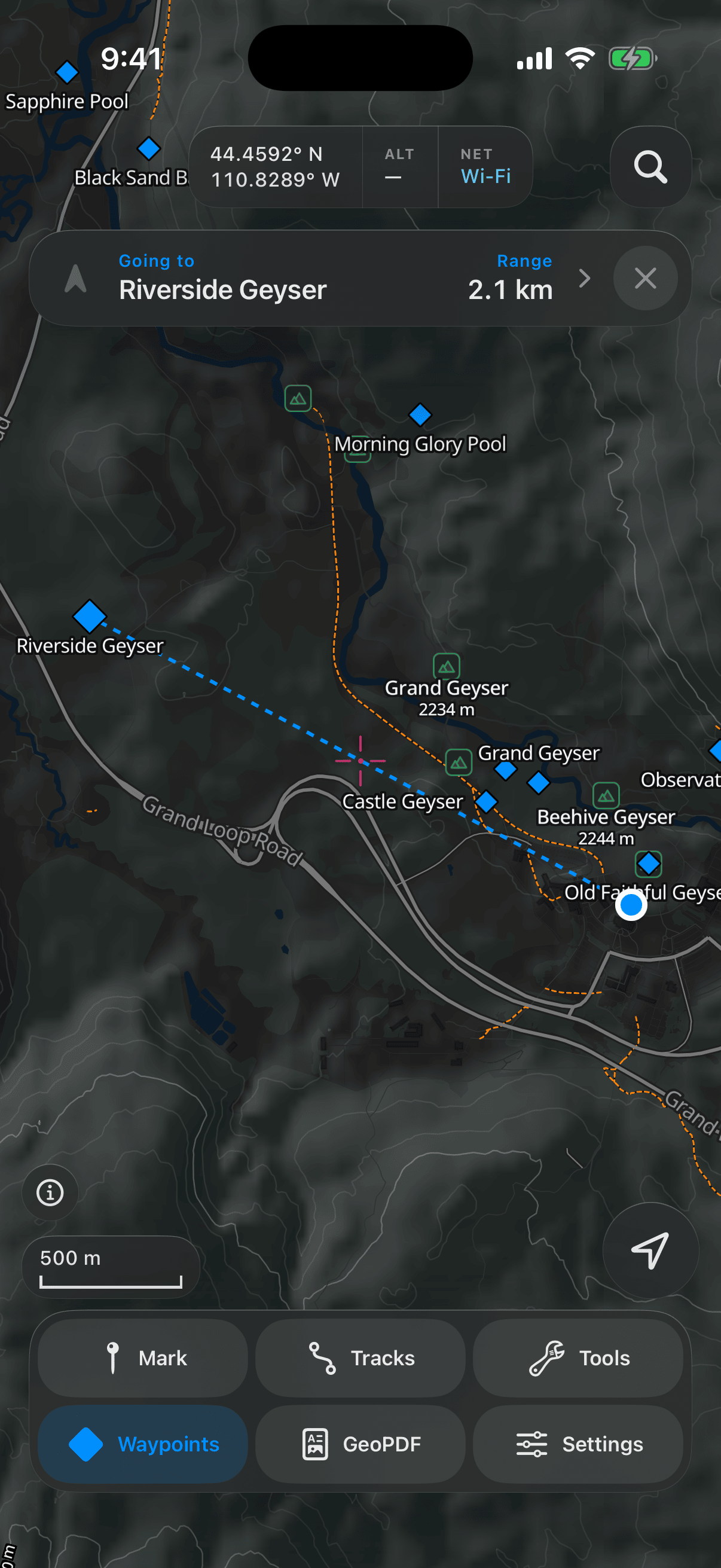
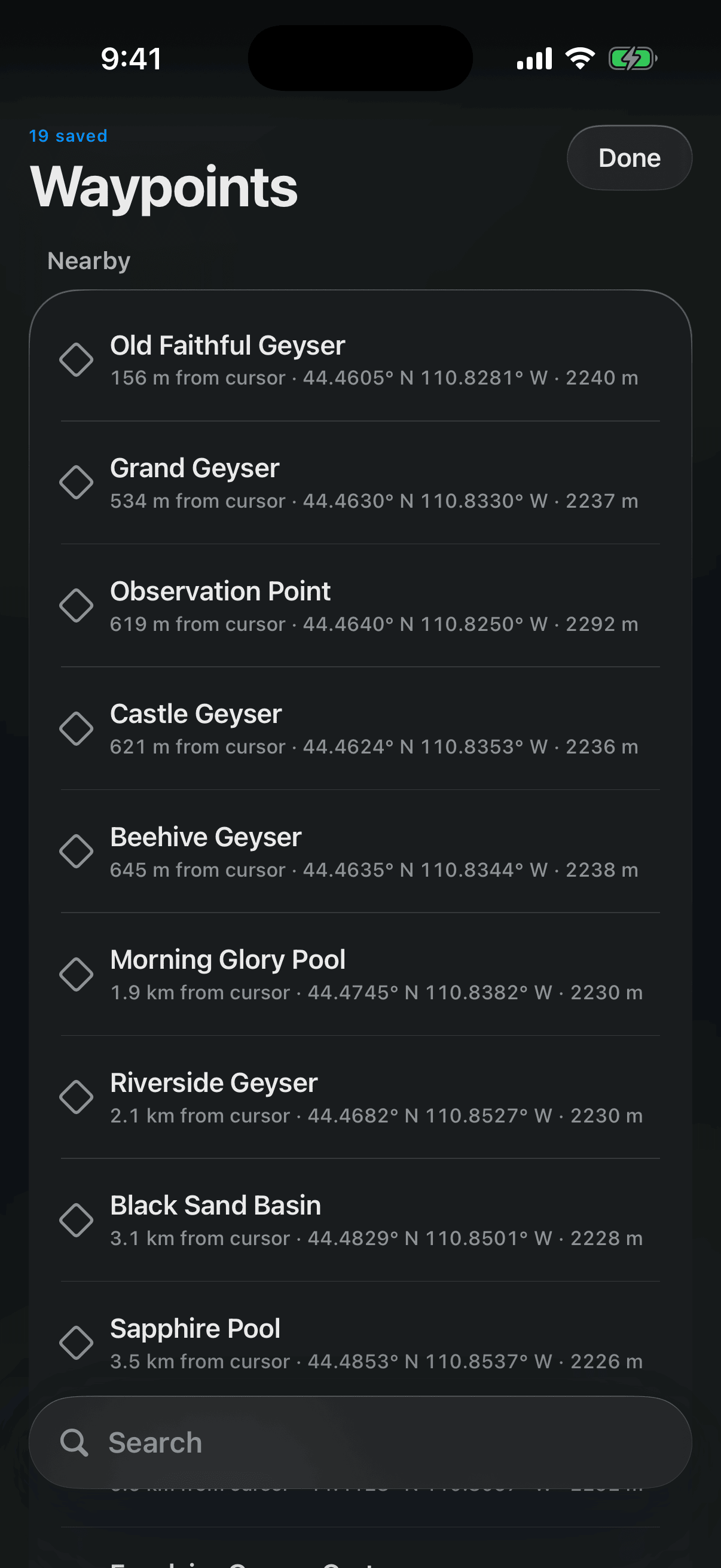
Open Waypoints to see everything you've marked. Each row shows its distance from the crosshair, its grid reference in your chosen format, and its elevation. Tap a row to start GOTO: you're returned to the map with a dashed line to the target and a Going to bar at the top carrying its name, the range left, and a compass arrow. Tapping the bar opens the waypoint in the library; the ✕ on it, or the waypoint's own pin on the map, stops navigating.
The arrow points at the waypoint from where you are, relative to the way you're facing — so you use it by turning, not by reading it. Turn on the spot until the arrow points straight up, and that's the way to walk. It's half-lit while the waypoint is off to one side and brightens once you're within about 12° of facing it, so you can line yourself up at a glance: turn until it lights, then go. Right means turn right; straight down means it's behind you. It keeps pointing at where the waypoint is now, from where you are now, so it stays right as you walk and as the leg bends round a spur — and the small ↑ or ↓ under the range is the climb or drop you've still got left, whenever both your position and the waypoint have an elevation.
In cloud, in trees or on a featureless plateau, turning until the arrow lights is the one thing that still works. It's the straight line to the target, though — it will point through a bluff or across a river, so let it tell you which way and let the map choose the way there.
Without a compass reading the arrow greys out and stops turning rather than freezing at a wrong angle. Hold the phone flat, away from magnets — a dashboard, a camera clip, a magnetic case — and move it in a figure of eight. VoiceOver reads the arrow as a clock face: "waypoint at 2 o'clock".
Point the map at a valley you're planning to walk and open Waypoints: the list is sorted around there, nearest first. Leave the map on yourself and it answers the old question.
Swipe left for Edit, GPX (hand the waypoint to Files or the share sheet) and Delete. A swipe alone never deletes anything.
Past ten, a search field appears at the bottom of the list — words in any order, any case.
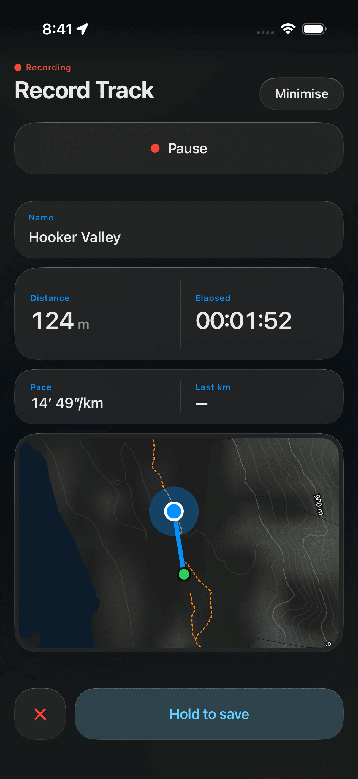
Open Tracks, then Record track. Name it and tap Record (that key becomes Pause and Resume as you go). Recording keeps going if you lock the phone or switch apps. The screen shows distance and elapsed time, then two live paces — Pace, a rolling average over the last fifty metres, and Last km, the split you've just closed. Save is a deliberate press-and-hold so a stray touch can't end the recording; the ✕ throws it away, and asks first.
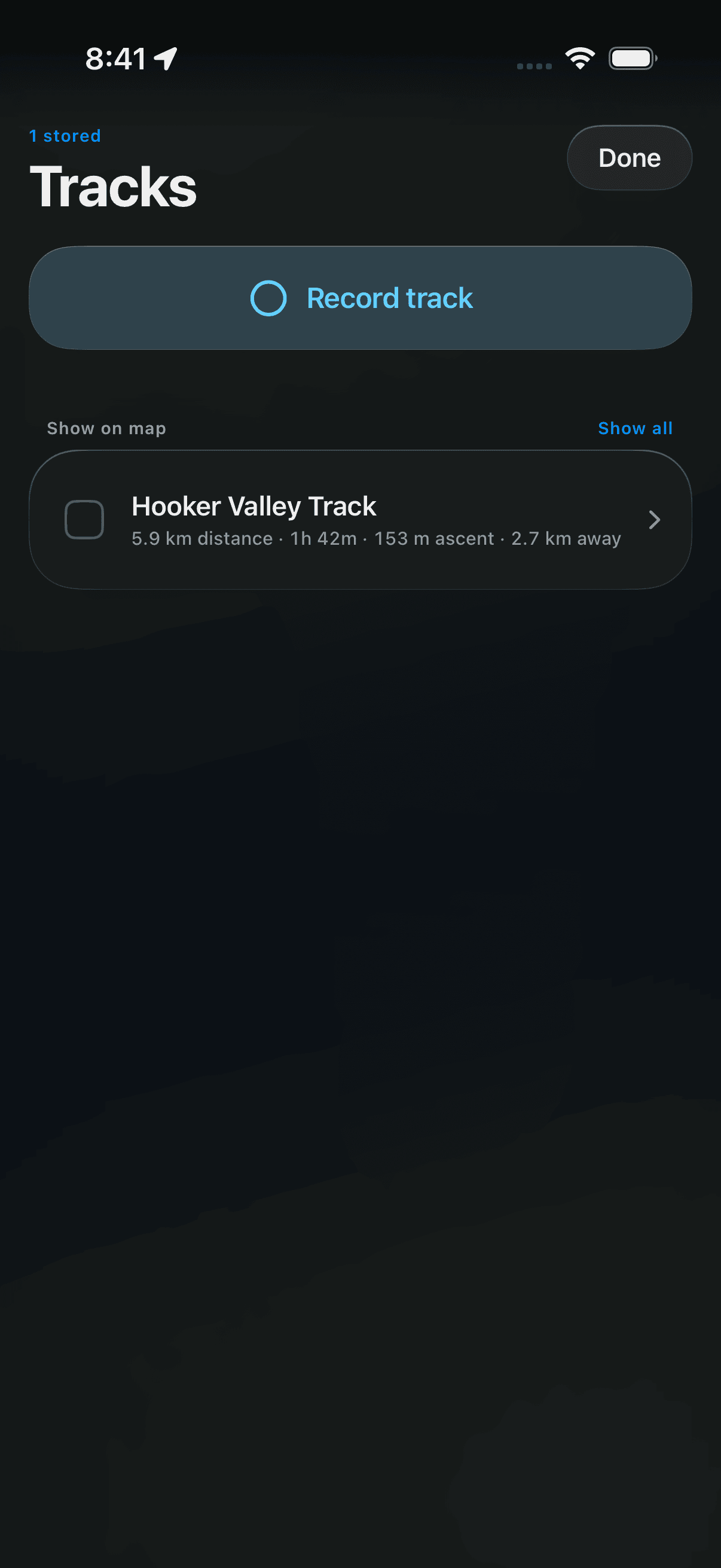
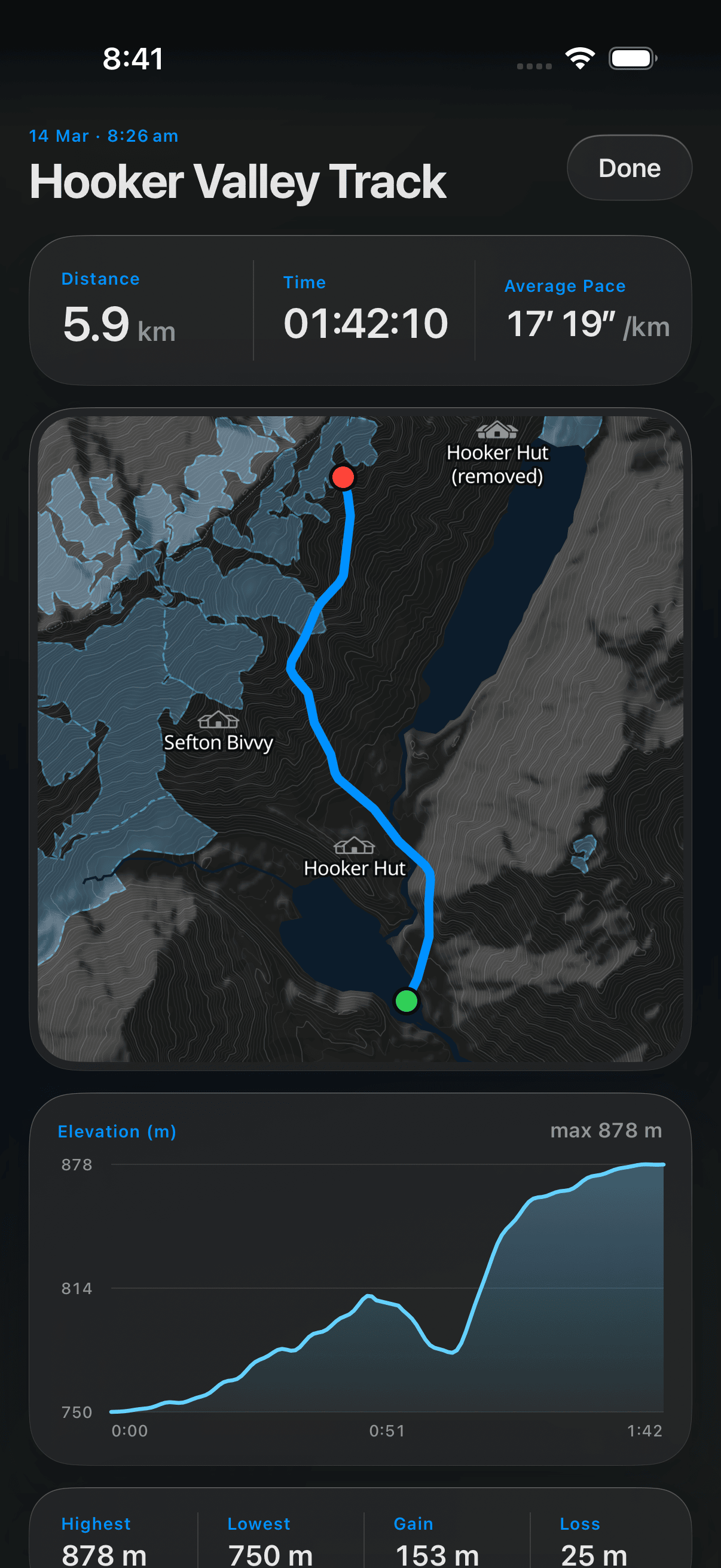
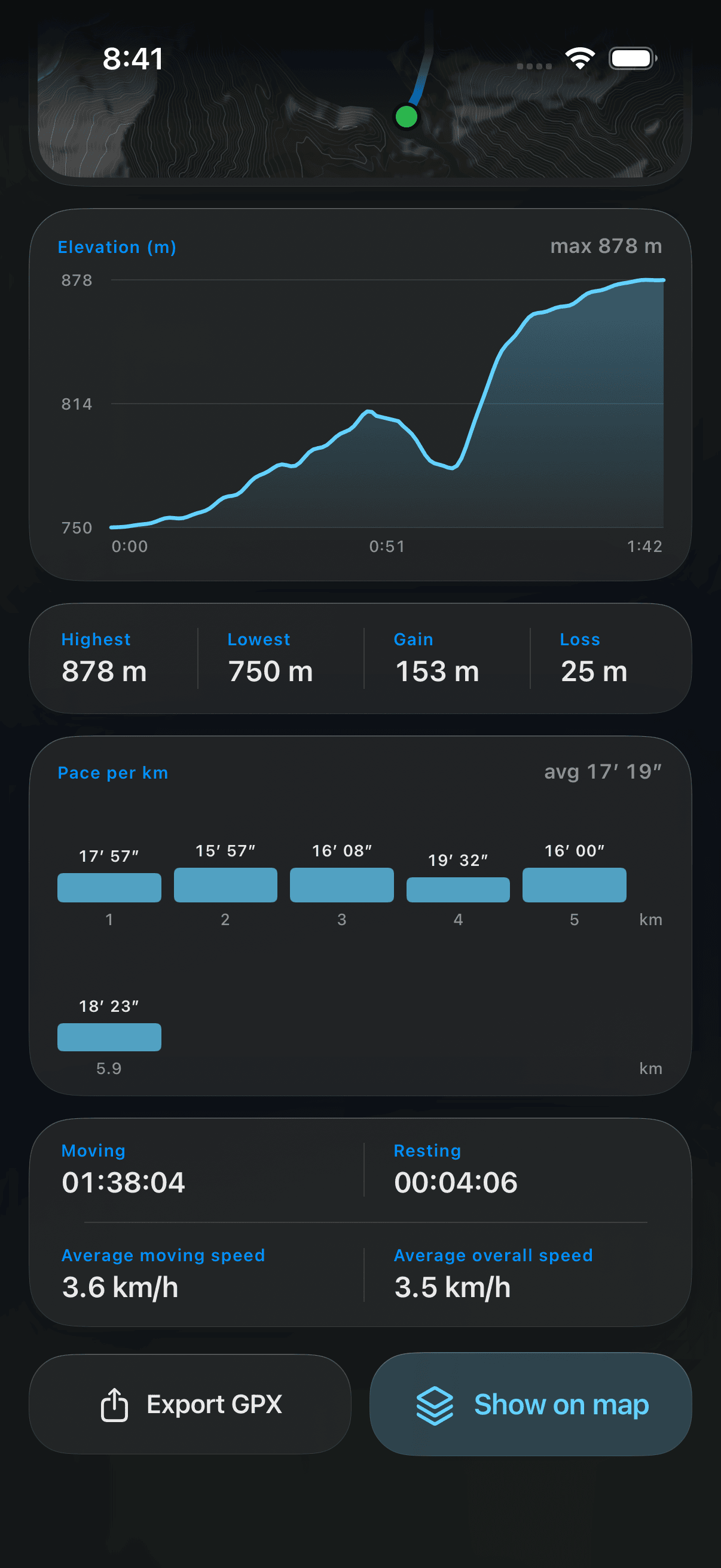
Tap a track to open it: the route on a map, how far and how long it was, your average pace, and an elevation profile with four figures under it — Highest, Lowest, and the total you climbed (Gain) and dropped (Loss) — then your pace for each kilometre, and your moving and resting time.
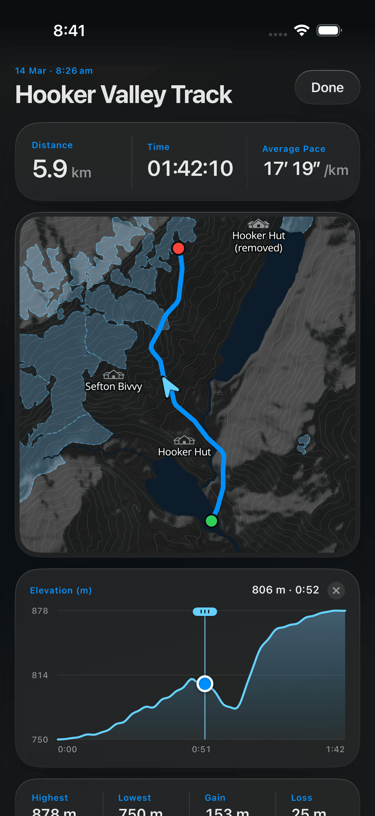
Tap the elevation profile and drag. A marker rides the profile while the map above shows where you were and which way you were going, with the height and elapsed time.
Highest and Lowest are two points on the map; Gain and Loss add up every rise and every fall in between. An undulating ridge can finish where it started and still hold a thousand metres of Gain — which is the figure that explains why it felt like one.
Read the Gain on a walk you remember as hard and you have a number to judge the next one by. Loss gets its own figure because descent is what knees and long steep days are made of — and on a there-and-back it's how much of the climb you've still to give back.
Anything slower than 1 km/h counts as a rest. Moving speed is how fast you go when you are going; Overall speed includes every stop.
Show on map draws the track on the main map and takes you to it. Tick a row's checkbox to keep several drawn at once.
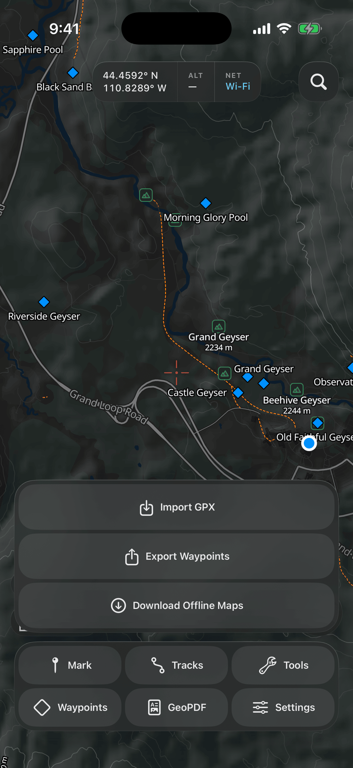
Tap Tools for three things: Import GPX (waypoints and tracks from a .gpx file via Files), Export Waypoints (every saved waypoint as one file) and Download Offline Maps. Importing skips waypoints you already have — same name, same place — and tells you how many it skipped.
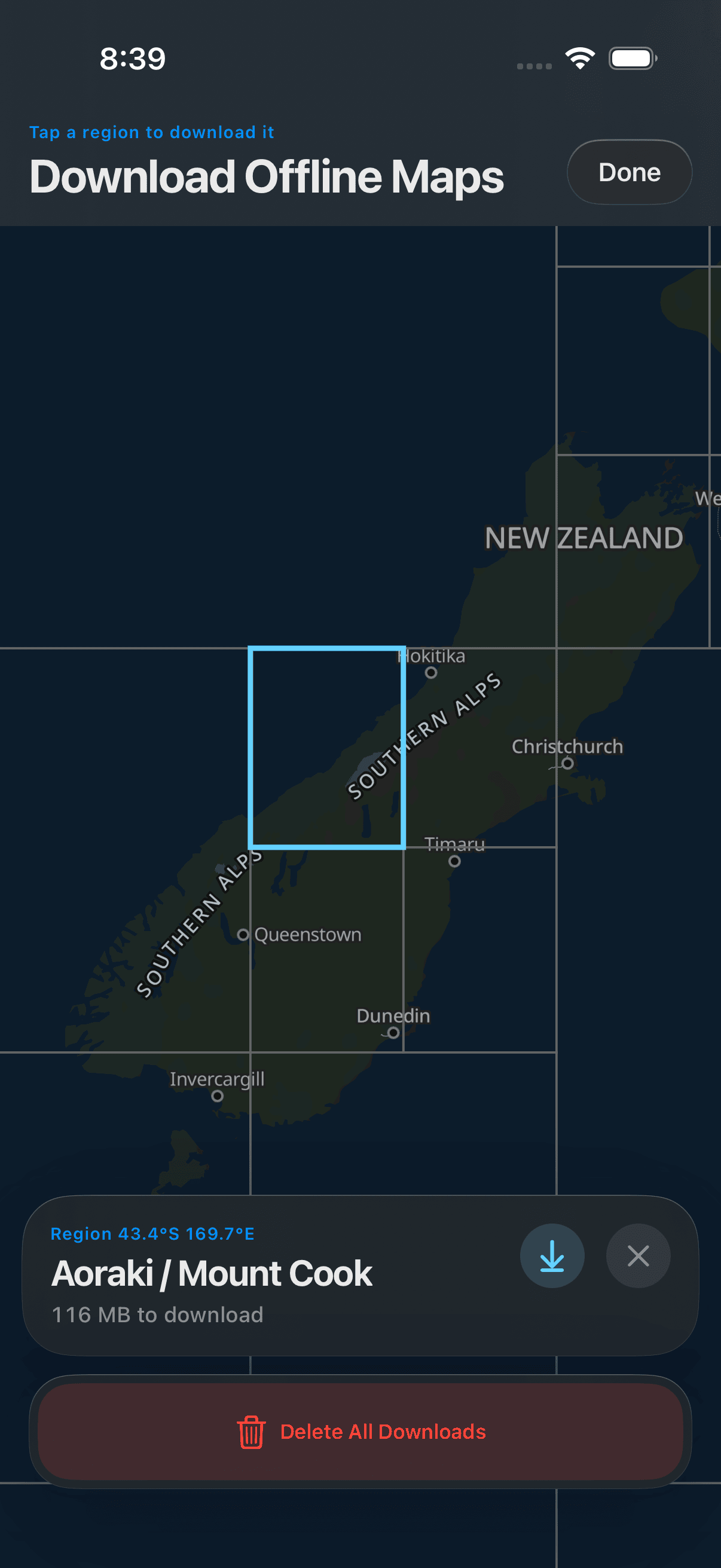
The world is split into a grid of downloadable regions, opening on where you are. Tap a region and its outline lights up while its card is open. Each region downloads as one package — the map, contour lines and shaded relief together — and its card tells you the total size. Once downloaded, that area keeps full detail with no signal at all, until you delete it (tap the same region again). Delete All Downloads, at the bottom of this screen, removes every region you've downloaded.
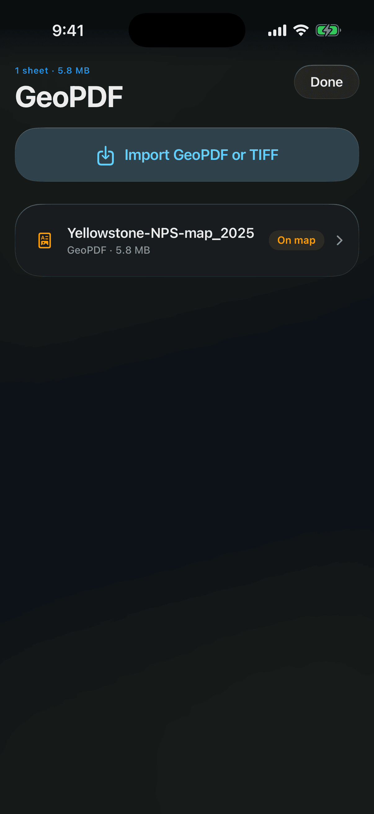
Tap GeoPDF for your own imported maps, each one opening as a full map screen with your position on it. Import GeoPDF or TIFF opens the Files browser — pick a georeferenced PDF or TIFF (a park map, a topo sheet, a printed plan) and it opens straight away.
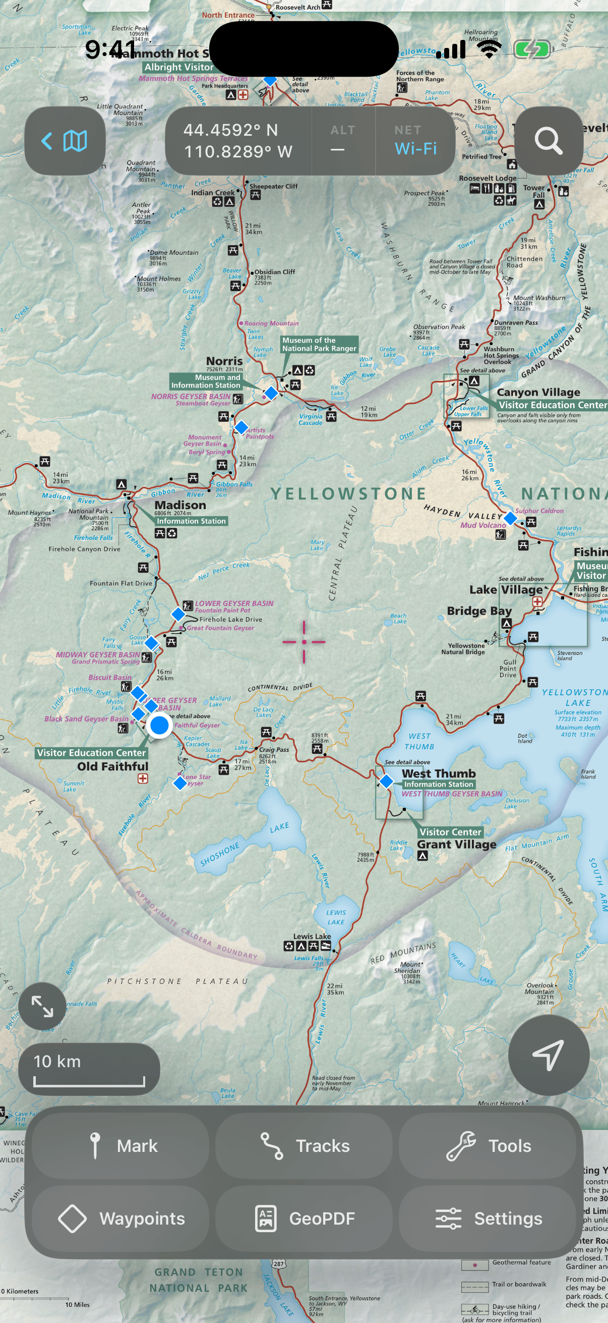
The map is shown exactly as it was drawn: nothing is redrawn, re-coloured or re-projected, right down to the legend and the collar, so it is on screen the moment you tap it. What the app adds is everything it knows about you — your position, your accuracy ring, the direction you're facing, every waypoint you've saved and every track you've ticked Show, placed on the paper where they actually are.
Centre on you, then turn the map so the way you're facing points up the screen, then back to as printed.
The key above the scale bar brings the whole page back. The small back key at the top left returns to the normal map, at the ground you were looking at.
Sheets the crosshair falls on get their own table at the top, with an orange On map pill. Pan the map to a walk you're planning and the library tells you which of your sheets covers it.
A file with no coordinates in it is refused and says so — without them there's no way to work out where on the paper you are.
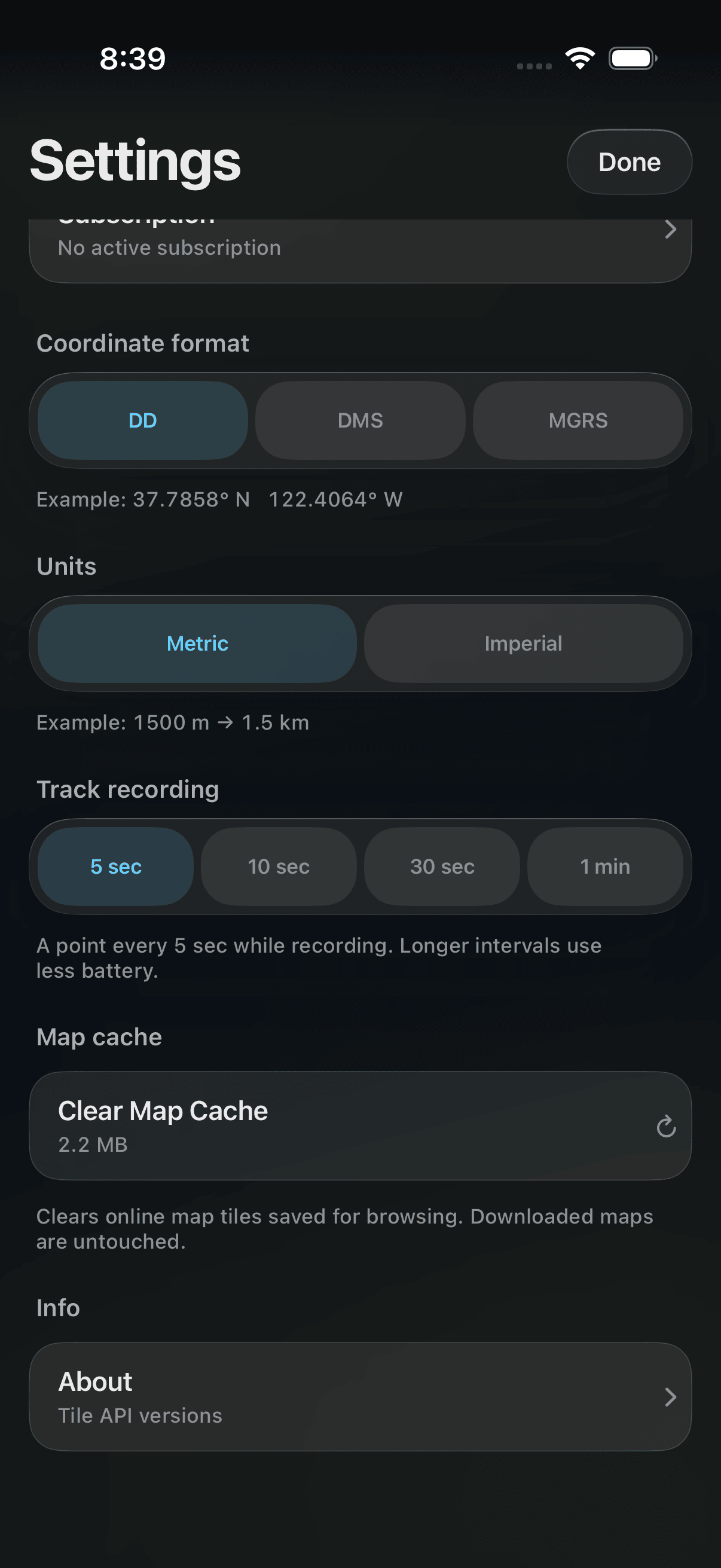
Settings opens with your Subscription: a row that says what you're on — Free trial with the days left, or Weekly plan or Annual plan with the renewal date. Tap it to open iOS's own manage-subscriptions sheet, where you can change plan or cancel. Switching from weekly to annual takes effect straight away and cancels the weekly plan for you.
Decimal degrees, DMS or MGRS — applies everywhere a coordinate is shown, immediately.
Metric or imperial, everywhere a distance is shown.
How often a recording drops a point: 5 sec, 10 sec, 30 sec or 1 min. Longer intervals use less battery; shorter ones keep more detail.
Clear Map Cache empties the tiles the app saved automatically while you browsed online — the row shows how much that is, or Nothing cached — and it never touches a region you deliberately downloaded.
Settings ▸ About shows the Version, Build, Source and Commit, with a Copy build details button for support messages.
Without a position the map opens on the whole world — it doesn't pretend to know where you are. Pan and zoom to wherever you're interested, or use search. Everything except recording a track still works: the map, search, your waypoints and tracks, imported PDF maps and offline downloads. What you lose is the blue dot, the map following you, and range and bearing on a GOTO. A bar under the readout says Enable location services to see your location on the map; tap it to open this app's page in Settings. When you turn location on it disappears straight away, without restarting the app.
Tap Restore purchase on the paywall. It brings back a subscription held on this Apple ID — for example after reinstalling or moving to a new phone. Make sure you are signed in to the same Apple ID that subscribed.
The whole world renders from install, but only in outline. For full detail with no signal, download the regions you will be in — see Download Offline Maps, above — before you go.
There is no location fix yet. Step outside with a clear view of the sky for a few seconds. If you declined location access, tap the bar under the readout to open this app’s page in Settings and turn it on.
Topograph needs a georeferenced PDF or TIFF — one that carries real-world coordinates — to work out where you are on the paper. A plain scan or picture has none.
Save it in a projected coordinate system such as Web Mercator (EPSG:3857) or your local UTM zone, not plain latitude/longitude (EPSG:4326), which is squashed top to bottom by the time it is drawn.
The two pace figures need distance to measure: Pace (50 m) after fifty metres and Last km after a kilometre. Keep walking.
Yes. The map, your position, waypoints, tracks and imported PDF maps all work with no signal. A world map is built into the app, and any region you download keeps its full detail in airplane mode.
Yes. Your first week is free, then you choose a weekly or annual plan. Every price shown comes from the App Store for your country. Cancel any time in Settings ▸ Subscription or in iOS Settings.
No — Apple does not send a reminder and neither does the app. If you do not want to be charged, cancel before the week is up.
No Topograph account. Your subscription is held by your Apple ID, and your waypoints and tracks are stored on your phone.
Georeferenced PDFs (GeoPDF) and GeoTIFFs — park maps, topo sheets from mapping agencies, printed plans. They are shown exactly as drawn, with your position, waypoints and ticked tracks placed on them.
Yes. Tools imports and exports standard GPX files, and each waypoint and track can also be exported on its own.
Each region downloads as one package — the map, contour lines and shaded relief together — and its card shows the total size before you tap, for example Yellowstone National Park — 216 MB.
Adapted from the Topograph user manual. Features may change as the app is updated.